
VERMONT SCENIC BYWAYS
The Crossroad of Vermont Byway
Cross central Vermont on Route 4 through Quechee Gorge, Woodstock, Killington, Rutland and a landscape that changes mile by mile.
ROUTE 4 • HARTFORD TO WEST RUTLAND
A Cross-Section of Central Vermont
The Crossroad of Vermont Byway follows Route 4 across central Vermont, connecting towns and geographic areas that show the diversity of the state’s landscape. The drive moves from the Connecticut River region through Quechee and Woodstock, climbs into Killington country, and continues west toward Rutland and West Rutland.
THE ROUTE
50 Miles Across the Green Mountain State
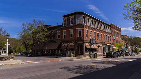
This east-west route is an easy distance for a day of sightseeing. Highlights include Quechee Gorge, quaint villages, Woodstock, four-season recreation around Killington, the Rutland area, and the historic mining landscape and wetlands of West Rutland.
EXPLORE THE CORRIDOR
Stops Along the Crossroad of Vermont
Leave room for gorges, historic villages, mountain recreation and the changing landscapes along Route 4.
Quechee Gorge
Begin the scenic story with one of Vermont’s best-known natural landmarks and the eastern Route 4 corridor.
Woodstock
Historic streets, architecture and a classic Vermont village landscape make Woodstock a natural place to linger.
Killington
The central mountain section is a major four-season recreation destination for skiing, riding and warm-weather activities.
Rutland
Route 4 reaches a regional center for dining, culture, shopping and connections to surrounding Vermont attractions.
West Rutland
The western section reflects the area’s historic mining heritage and distinctive central Vermont landscape.
West Rutland Marsh
The original Scenic Vermont page highlights this 451-acre wetland as a favorite destination for bird enthusiasts.
PLAN THE DRIVE
Get to Know the Crossroads of Vermont
Nestled in the heart of New England, Vermont is famous for its picturesque landscapes, covered bridges, and vibrant fall foliage. The Crossroads of Vermont, located in the central part of the state, is where history meets outdoor adventure, creating a unique blend of experiences for visitors of all ages.
PLAN THE DRIVE
Keep the Original Byway Map Handy
The original Vermont Agency of Transportation map traces the Crossroad of Vermont corridor across central Vermont and shows Route 4, connecting highways, communities, mountains, ponds and surrounding scenic roads.
KEEP EXPLORING
Discover More Vermont Scenic Byways
Connect Route 4 with more scenic roads, historic communities and classic Vermont landscapes.