
VERMONT SCENIC BYWAYS
Stone Valley Scenic Byway
Follow Route 30 through a west-central Vermont landscape shaped by slate, marble, mountain slopes and historic communities.
ROUTE 30 • MANCHESTER TO POULTNEY
A Valley Shaped by Stone
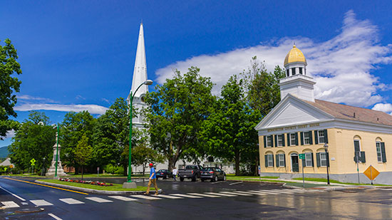
The Stone Valley Scenic Byway celebrates a region whose identity grew around some of America’s noted marble and slate quarries and mills. Mountain slopes form a dramatic backdrop to rural landscapes, historic towns, farms and outdoor recreation.
THE ROUTE
30 Miles of History & Scenery
The original Scenic Vermont page centers the byway on Route 30 from Manchester to Poultney and lists Rupert, Pawlet and Wells along the corridor, with Castleton and Hubbardton included in the broader route. The valley combines stone-industry history with scenic, recreational and cultural experiences.
EXPLORE THE CORRIDOR
Stops Along the Stone Valley Byway
Leave time for historic towns, quarry heritage, mountain views and recreation along Route 30.
Manchester
Begin amid historic streets, culture and mountain scenery at the southern end of the byway.
Dorset
Discover a community closely tied to Vermont’s marble history and cultural traditions.
Rupert
Route 30 carries the drive through rural landscapes framed by the surrounding mountains.
Pawlet
Historic village scenery and agricultural land reinforce the valley’s classic Vermont character.
Wells
Continue north toward Lake St. Catherine and the recreational landscape of Stone Valley.
Poultney
The northern anchor reflects the region’s slate heritage, history and small-town character.
PLAN THE DRIVE
Get to Know the Stone Valley Byway
The Stone Valley Byway is a designated scenic drive that spans through the stunning countryside of upstate New York. This 90-mile route takes you on a journey through rolling hills, sprawling farmlands, and quaint towns that are rich in history and charm. As you drive along the byway, you’ll be greeted by breathtaking views of the Adirondack Mountains and the gentle flow of the Oswegatchie River, making it a truly unforgettable experience.
PLAN THE DRIVE
Keep the Original Byway Map Handy
The original Vermont Agency of Transportation map traces the Stone Valley Byway corridor across central Vermont and shows Route 4, connecting highways, communities, mountains, ponds and surrounding scenic roads.
KEEP EXPLORING
Discover More Vermont Scenic Byways
Connect Stone Valley with more scenic roads, historic communities and classic Vermont landscapes.