
VERMONT SCENIC BYWAYS
Scenic Route 100 Byway
Travel Vermont’s Main Street from Whitingham to Granville through Green Mountain scenery, farms, white-steeple villages and legendary ski country.
ROUTE 100 • WHITINGHAM TO GRANVILLE
Vermont's Main Street
Running along the eastern edge of the Green Mountains, the Scenic Route 100 Byway winds through rural farmland and classic New England villages. Also known as The Skier’s Highway, it links mountain recreation with the small towns, culture and landscapes that define south-central Vermont.
THE ROUTE
146 Miles of Vermont Discoveries
From Whitingham to Granville, Route 100 is an easy road to explore slowly. Build in time for sightseeing, village stops, mountain views, dining, lodging, history, culture and one-of-a-kind Vermont art, crafts and furniture.
EXPLORE THE CORRIDOR
Stops & Experiences Along Route 100
Leave time for villages, recreation, local culture and the scenery between destinations.
Whitingham
Begin in southern Vermont among rural landscapes and classic Green Mountain scenery.
Mountain Villages
Follow Route 100 through white-steeple communities and working Vermont countryside.
Weston
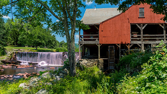
The original Scenic Vermont photograph captures Weston’s red mill and waterfall beside the scenic route.
Ski Country
Route 100 earned its Skier’s Highway nickname by connecting some of the Northeast’s best skiing and riding.
Outdoor Vermont
Beyond winter, the corridor offers hiking, biking and golf from late spring through fall.
Granville
Reach the northern end of this 146-mile byway amid central Vermont mountain and valley scenery.
PLAN THE DRIVE
Get to Know the Scenic Route 100 Byway.
The Route 100 Byway is a designated scenic highway that runs from Massachusetts to the Canadian border in Vermont. It covers approximately 200 miles of some of the most stunning landscapes New England has to offer. The road winds its way through the Green Mountains, passing through quaint villages, historic sites, and countless photo-worthy spots along the way.
PLAN THE DRIVE
Keep the Original Byway Map Handy
The original Vermont Agency of Transportation map traces the Scenic Route 100 Byway corridor across central Vermont and shows Route 4, connecting highways, communities, mountains, ponds and surrounding scenic roads.
PLAN THE DRIVE
A Road Made for Taking Your Time
The original Scenic Vermont guide recommends late spring through early fall for the scenic drive, while winter turns Route 100 into a link between major ski and riding destinations. Whatever the season, the route rewards frequent stops.
KEEP EXPLORING
Discover More Vermont Scenic Byways
Connect Route 100 with more scenic roads, historic communities and classic Vermont landscapes.