
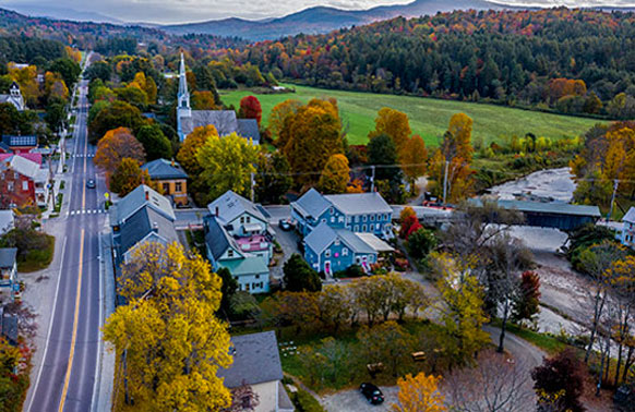
Exploring the Beauty of Scenic Drives Through the Green Mountains
Are you in search of a breathtaking adventure that will leave you in awe of nature’s beauty? Look no further than the Green Mountains, where scenic drives offer a truly unforgettable experience. From winding roads that take you through lush forests to panoramic views of rolling hills, a journey through the Green Mountains is a must for any nature lover. So, buckle up and get ready to discover the wonders that await you on these picturesque drives!
The Green Mountains: A Nature Lover’s Paradise
The Green Mountains, located in Vermont, are a haven for outdoor enthusiasts and nature lovers alike. Stretching over 250 miles, this stunning mountain range is home to an array of flora and fauna, making it a paradise for those looking to immerse themselves in the beauty of the natural world. As you embark on a scenic drive through the Green Mountains, you’ll be greeted by towering trees, colorful wildflowers, and the soothing sounds of birds chirping in the distance.
Route 100: Vermont’s Classic Scenic Byway
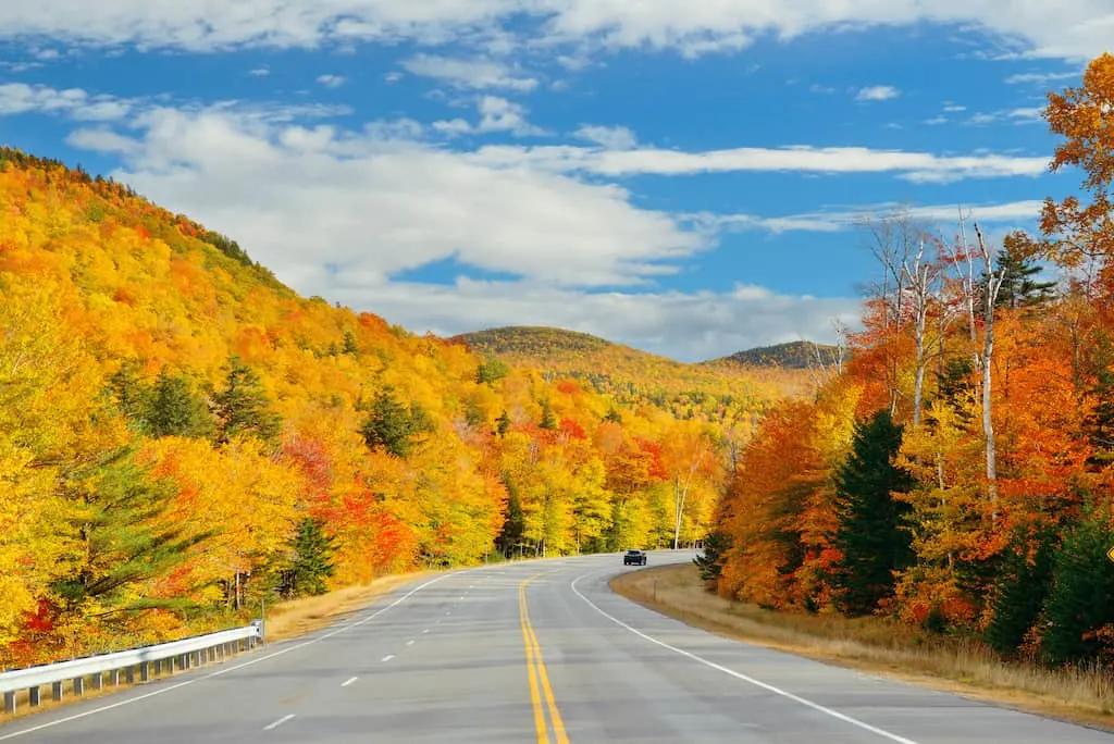
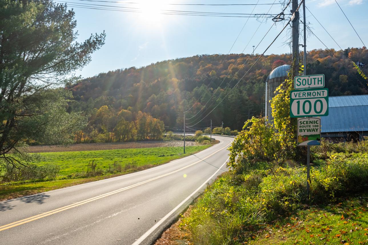
Often called Vermont’s “Main Street,” Route 100 stretches through the heart of the Green Mountains and connects many of the state’s most popular destinations. Travelers pass ski resorts, covered bridges, waterfalls, and postcard-worthy villages while enjoying some of New England’s most spectacular scenery.
Must-Stop Towns & Attractions
- Stowe — the most polished Vermont village, with the Stowe Community Church steeple framing every classic photo. Walk the Recreation Path along the West Branch River.
- Waitsfield & Warren — twin Mad River Valley towns with excellent independent restaurants, the Warren Store (a local institution), and access to Sugarbush Resort.
- Ludlow — southern anchor of Rt 100, home to Okemo Mountain and the Black River. Good fuel-and-food stop.
- Jamaica State Park — pull off for a picnic or short hike along the West River.
Best Viewpoints & Photo Spots
- Stowe’s Recreation Path at dawn — mist over the mountains with the church steeple in the distance.
- Granville Gulf (between Granville and Warren) — a narrow, forested gorge on Rt 100 with Moss Glen Falls right at the roadside. One of the most-photographed stops in Vermont.
- Hogback pull-offs south of Waitsfield — informal roadside views across farm fields to the mountains.
Practical Tips
- The full Rt 100 north-south run is about 216 miles and takes 5–6 hours without stops — most people do a section.
- From Montpelier, the Waitsfield–Stowe stretch (about 45 miles) is the cream of the crop.
- Foliage weekends in early October see heavy traffic between Stowe and Waterbury. Go early (before 9am) or on a weekday.
Smugglers’ Notch
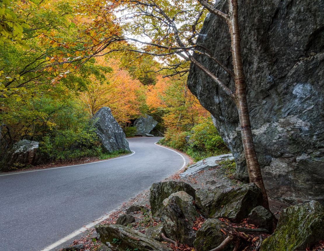
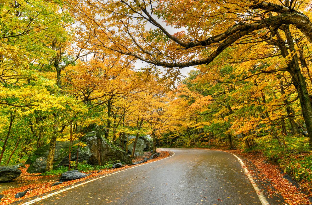
This narrow mountain pass between Stowe and Jeffersonville is famous for its towering rock formations, dramatic cliffs, and winding roadway. The notch becomes especially stunning during peak foliage season when colorful trees frame the rugged mountain landscape.
WARNING: Single vehicles longer than 40 ft and combination vehicles longer than 45 ft are legally banned from the Notch. Driving a prohibited vehicle through the pass carries a penalty of up to $10,000.
Must-Stop Towns & Attractions
- Stowe (south end) — use it as your base; the drive through the Notch and back makes a perfect half-day loop.
- Jeffersonville (north end) — a quieter, artsy village on the other side of the Notch. The Vermont Artisan Designs gallery and a handful of good cafés are worth a stop.
- Smugglers’ Notch State Park — the pass itself is the attraction. Massive house-sized boulders line the road and trail. There’s a small pullout near the summit for exploring on foot.
Best Viewpoints & Photo Spots
- The summit pullout in the Notch itself — stand among the boulders and look up at the cliff faces. Unlike anything else in Vermont.
- Bingham Falls — a short trail off Rt 108 just north of Stowe leads to a gorgeous waterfall hidden in the woods.
- Looking back south from the Jeffersonville side gives a great view of the Notch entrance framed by Mount Mansfield’s ridgeline.
Practical Tips
- Closed mid-October through late May — check vtrans.vermont.gov before going.
- No RVs, trailers, or buses are permitted through the Notch. The road narrows to one lane in places.
- Pull completely off the road at the boulder areas — other cars will be doing the same.
- Allow extra time: the temptation to stop every 200 yards is very real.
The Gap Roads — Lincoln & Appalachian Gap
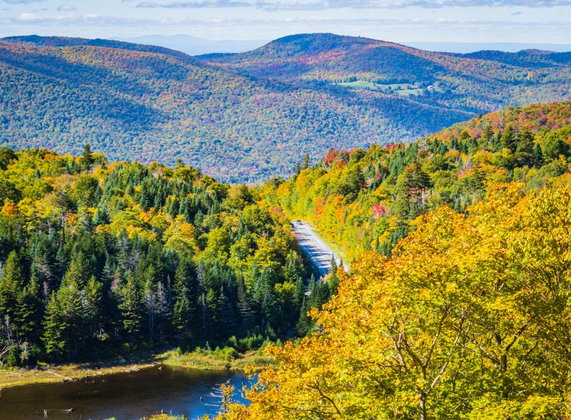
The Appalachian Gap is one of Vermont’s most scenic mountain crossings. The route climbs through dense forests before opening to expansive views of valleys, ridgelines, and distant peaks.
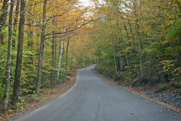
Lincoln Gap offers a quieter alternative to more famous scenic routes. Narrow roads and dramatic mountain scenery make it a favorite among photographers and cyclists.
Must-Stop Towns & Attractions
- Waitsfield (base of App Gap, east side) — great starting point. Grab coffee at the Mad Twisters or breakfast at the Pitcher Inn before climbing.
- Starksboro / Bristol (west side of both gaps) — sleepy agricultural towns with a classic Vermont feel. Bristol has a nice little downtown with a bookshop and diner.
- Lincoln — a tiny village tucked between the two gaps, with the New Haven River running through it. Perfect for a picnic stop.
- Robert Frost Interpretive Trail near Ripton (near Middlebury Gap, just south) — a flat, easy walk through the woods with Frost poems on signs along the path.
Best Viewpoints & Photo Spots
- Appalachian Gap summit — looking east down into the Mad River Valley is one of the great Vermont views. The drop is dramatic and the valley farms spread out below you.
- Lincoln Gap summit — slightly more rugged and less trafficked. The western view toward the Champlain Valley and the Adirondacks beyond is stunning on a clear day.
- The covered bridge in Waitsfield (the 1833 Warren Bridge) is one of the most photographed in Vermont — easy roadside stop.
Practical Tips
- Both gap roads are closed in winter — typically November through April/May depending on conditions.
- Lincoln Gap Road is extremely steep (up to 18% grade) on the east side. Take it slow on the descent; it’s not for the faint-hearted in wet conditions.
- These roads are narrow with no guardrails in places — pull well off the road if stopping.
- App Gap (Rt 17) is a designated cycling route and very popular with road cyclists on weekends. Give them plenty of room.
Mount Mansfield Auto Toll Road
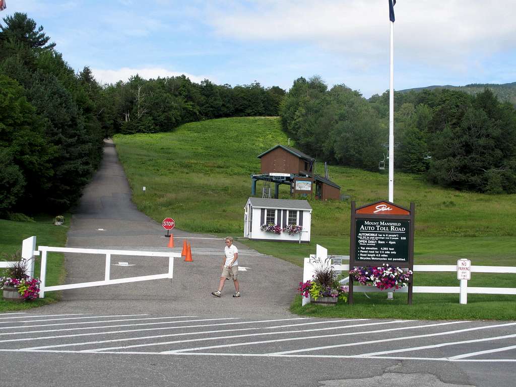
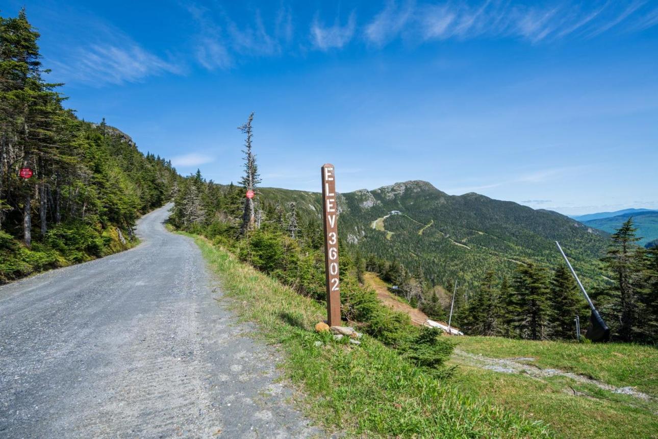
Since 1923, the Auto Toll Road has brought visitors up the slopes of Mount Mansfield — Vermont’s highest peak — along a scenic 4.5-mile route with sweeping views of Lake Champlain, the Adirondacks, and the Green Mountains.
The road doesn’t take you to the absolute summit. It brings you to the “Nose,” and a hiking trail then leads 1.4 miles to the “Chin” — the actual highest peak. In winter, the road converts to a ski trail and hosts one of the oldest ski events in North America: the Stowe Derby.
Cost
The toll is $37 per car, plus $14 per additional passenger. So two people would run about $51 — cash only, no electronic payment accepted.
The Drive
As you drive, the hardwood forests of the valley slowly give way to a rugged world of stunted balsam fir and spruce trees. Once you reach the parking area at nearly 3,850 feet, you can step out and explore rare alpine tundra.
Your zigzag ascent to 4,000 feet passes boulders and exposed mountainsides, with beech, yellow birch, and spruce trees — featuring striking foliage in fall — canopying the journey before unexpectedly opening to a grand vista of ski runs and Smugglers’ Notch. Looking west at the summit reveals the Adirondack Mountains and Lake Champlain.
Vehicle & Practical Tips
The road is gravel and best suited for AWD or 4×4 vehicles. Some 2WD vehicles can manage, but it can stress the transmission, especially if the road is wet.
No trucks or motorcycles are allowed.
The drive up takes approximately 30–45 minutes depending on traffic and how often you stop.
It is much colder and windier at the top than in Stowe — bring a windbreaker or warm jacket even on a hot summer day at the bottom.
The entrance is off Route 108, just beyond the cross-country center at Stowe Mountain Resort.
Lake Willoughby & the Northeast Kingdom
The Northeast Kingdom — Vermont’s three northeasternmost counties of Orleans, Essex, and Caledonia — is the most remote and least-touristed corner of New England. It rewards those who make the effort with dramatic landscapes, near-total solitude, and an authentically rural Vermont that feels untouched.
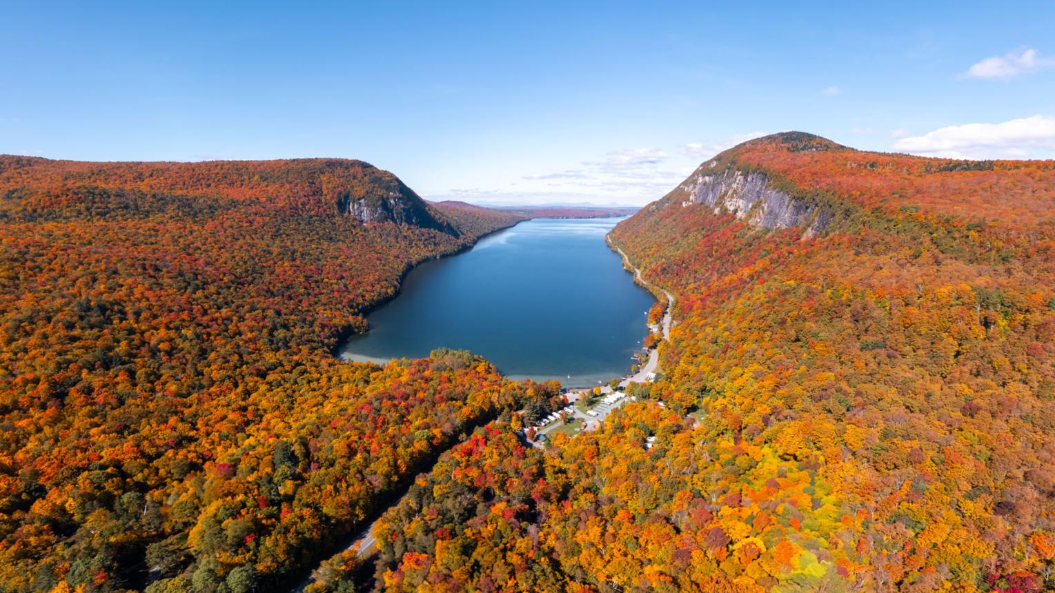
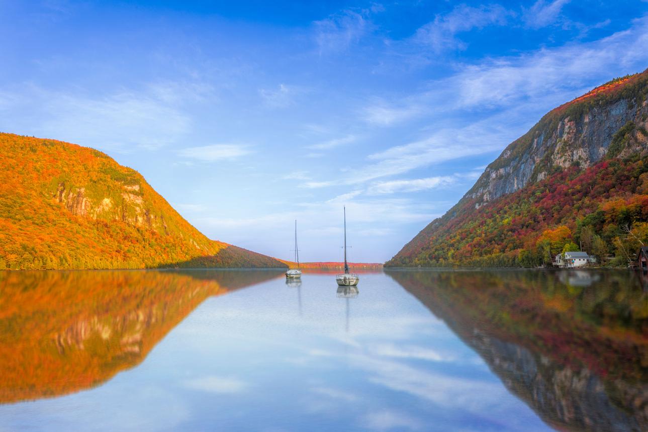
Nothing adequately prepares you for the spectacle of Lake Willoughby — a glacial gash between two fjord-like mountains. Its ice-carved splendor reveals itself like a secret and takes your breath away. Dramatic cliffs rise above the glacial depths — Vermont’s second-deepest lake — and two steep mountains, Mount Hor and Mount Pisgah, rise up on either side.
The moment when Lake Willoughby first comes into view is consistently rated as one of Vermont’s most dramatic scenic reveals.
How to approach it: The northern approach on Route 58 is arguably the most awesome. After passing through the rural towns of Lowell, Irasburg, Orleans, Brownington, and Evansville, the road climbs to a stunning view of the Willoughby Gap, where the sheer cliffs of Mount Pisgah and Mount Hor rise up on either side of the deep blue water.
Route 5A skirts the eastern edge of Lake Willoughby, offering dramatic views of sheer cliffs and crystal-clear waters. Several pull-off areas make it easy to stop and admire the view or take a photo.
Darling Hill Road — East Burke
Darling Hill Road offers one of the most scenic drives in the Northeast Kingdom, running from Lyndonville through East Burke toward Burke Mountain. The route delivers sweeping vistas and mountain views along approximately 12 miles, taking about 30–45 minutes. This is an unpaved country road past working farms with long views in every direction — the kind of drive that makes you pull over every quarter mile.
East Burke itself is the hub of the region, home to the legendary Kingdom Trails — an extensive network of scenic recreational trails providing epic mountain biking constructed to accommodate all levels and abilities.
Burke Mountain Toll Road
For dramatic views of the Green Mountains and Willoughby Gap, drive the historic toll road to the Burke Mountain summit. The fire tower at the top gives a 360-degree panorama that includes Lake Willoughby’s notch visible in the distance — a remarkable sight. More information including rates is available on the Burke Mountain Resort website.
Newport & Lake Memphremagog
Newport sits on the southern shore of Lake Memphremagog, a stunning 30-mile-long lake that stretches north across the Canadian border into Quebec. The waterfront downtown has excellent views and a few good restaurants. A scenic back-road loop starts at Lavender Essentials of Vermont for breathtaking views overlooking Lake Memphremagog, then follows Nelson Hill Road to Derby Pond Road for a view of Lake Derby.
Route 105 — The Long Wild Road
Stretching from Bloomfield to Derby, Route 105 winds through farmland, forests, and river valleys — a perfect drive for those who enjoy varied landscapes and small-town charm. The Clyde River and nearby wetlands offer tranquil photo stops and wildlife viewing. Along the way, enjoy trails in the Silvio O. Conte National Fish and Wildlife Refuge and picnic spots near Island Pond. This is the most remote stretch — moose sightings are genuinely common at dawn and dusk.
St. Johnsbury — Gateway to the Kingdom
The largest town in the Northeast Kingdom and the natural starting point from Montpelier (about 1 hour via I-91 or the more scenic Route 2). Don’t miss:
- The St. Johnsbury Athenaeum — a stunning 1871 Victorian art gallery and public library, one of the finest small museums in New England, with an Albert Bierstadt panorama painting as its centerpiece.
- Fairbanks Museum & Planetarium — a Victorian natural history museum with an extraordinary collection and a working planetarium.
- Maple Grove Farms — the world’s largest maple candy factory, with tours and a gift shop.
Practical Tips
- Best season: Late September to mid-October for foliage — the Kingdom peaks about a week earlier than southern Vermont due to elevation and northern latitude. Early October is the sweet spot.
- Moose: Route 105 and the roads around Island Pond and the Connecticut Lakes are among the best moose habitat in Vermont. Dawn and dusk are peak viewing times — drive slowly.
- Services are sparse. Fill your gas tank before leaving St. Johnsbury or Newport. Island Pond has a small general store but don’t count on much else in the deep Kingdom.
- Route 58 over Willoughby Gap can be muddy or rough in spring — check conditions before April or May visits.
- The Northeast Kingdom has almost no cell service once you’re away from the main towns. Download offline maps before you go.
Green Mountain National Forest
The Green Mountain National Forest covers nearly 400,000 acres across two separate units — northern (Addison and Washington counties) and southern (Rutland, Bennington, and Windham counties). Unlike a national park, there are no entrance fees and no gates — the forest roads and scenic highways run freely through it. Here are the best drives, organized north to south.
Route 125 — Middlebury Gap Road (Northern Unit)
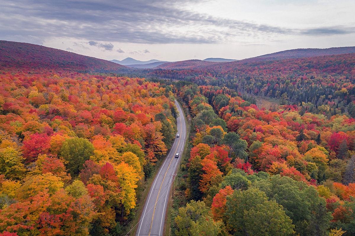
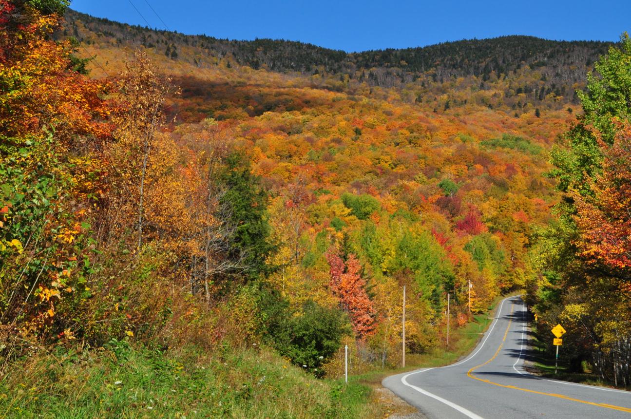
Route 125, the Middlebury Gap Road, was established as a State Scenic Road in 1987 under the Vermont Scenic Roads Law. The trip starts in East Middlebury and travels just 15 miles through the Green Mountain National Forest to the town of Hancock.
This is one of the finest short drives in Vermont. Route 125 climbs up into Middlebury Gap itself at 2,149 feet, marked by a sign for the Long Trail — the 255-mile trail running the spine of the state. Deep in the forest, a big yellow 1860s hotel suddenly appears: the Bread Loaf Conference Center, owned by Middlebury College and well known for its summer literary programs.
Must-stop along Route 125:
- Texas Falls Recreation Area offers viewing of cascading falls along scenic gorges, a 1.2-mile loop trail for hiking and snowshoeing, a large picnic pavilion, and dispersed fishing along Hancock Branch and Texas Brook. The falls began forming 12,000 years ago as glacial meltwater carved through bedrock — the potholes are still visible.
- Robert Frost Wayside Area — just west of Bread Loaf, with picnic tables, grills, and a map of the neighboring Moosalamoo Wilderness Area with its campsites and mountain-biking trails. A bit farther west, past a classic old Vermont cemetery, is the Robert Frost Interpretive Trail.
- Falls of Lana nearby in Salisbury: a beautiful cascade flowing between two rocks, with a 4-mile loop that includes views from Rattlesnake Cliffs and connects to Silver Lake.
Brandon — the charming western anchor of the Route 73 gap drive
Route 73 east-to-west excursions tantalize the visitor to stop for a picnic lunch or walk along a cold mountain stream as the road winds through the rural Vermont countryside. At the base of the 800-foot Great Cliff of Mount Horrid, just east of the Brandon Gap mountain pass, is the Mt. Horrid observation site — a pull-out with views of the Great Cliff and a vantage point overlooking a large wetland complex and beaver pond.
The Middlebury Loop combines Routes 125 and 73 into an 81-mile circuit: crossing the Green Mountains via Middlebury and Brandon Gaps, with diverse scenery sampling farmland and orchards, the Lake Champlain waterfront, superb mountain views, and a host of picturesque country villages. This is one of the great all-day loops in Vermont.
Forest Road 10 — Danby-Mount Tabor Road (Southern Unit)
The Danby-Mount Tabor Road, also known as Forest Road 10, travels east from Danby/Mt. Tabor over the Green Mountains to the Peru/Londonderry area. Built by the Civilian Conservation Corps in the 1930s, it features several vistas, a picnic area at the Big Branch Day Use Area, and plenty of wildlife viewing opportunities. This is the most off-the-beaten-path drive in the National Forest — unpaved, quiet, and deeply forested. Closed in winter.
Forest Road 21 & 58 — Mad Tom Notch (Southern Unit)
Follow Mad Tom Notch Road (Forest Road 21) up into the Green Mountain National Forest from the town of Peru. Turning right onto Forest Road 58 takes the traveler higher into the mountains, affording a fine view of the Manchester Valley. This is a hidden gem, virtually unknown outside locals and serious hikers. usda
Tips for a Memorable Drive Through the Green Mountains
- Pack a picnic lunch and stop at one of the many scenic overlooks along the way to enjoy a meal with a view.
- Keep your camera handy to capture the stunning scenery and wildlife you may encounter during your drive.
- Take your time and savor the moment – the Green Mountains are meant to be explored at a leisurely pace.A scenic drive through the Green Mountains is an experience not to be missed. From the vibrant greenery to the majestic mountains, this journey offers a glimpse of the natural beauty that Vermont has to offer. So, grab your keys, hit the road, and prepare to be amazed by the wonders that await you on this unforgettable adventure through the Green Mountains.
Vermont’s Scenic Byways.

Tips for a Memorable Drive Through the Green Mountains
- Pack a picnic lunch and stop at one of the many scenic overlooks along the way to enjoy a meal with a view.
- Keep your camera handy to capture the stunning scenery and wildlife you may encounter during your drive.
- Take your time and savor the moment – the Green Mountains are meant to be explored at a leisurely pace.
In conclusion, a scenic drive through the Green Mountains is an experience not to be missed. From the vibrant greenery to the majestic mountains, this journey offers a glimpse of the natural beauty that Vermont has to offer. So, grab your keys, hit the road, and prepare to be amazed by the wonders that await you on this unforgettable adventure through the Green Mountains.